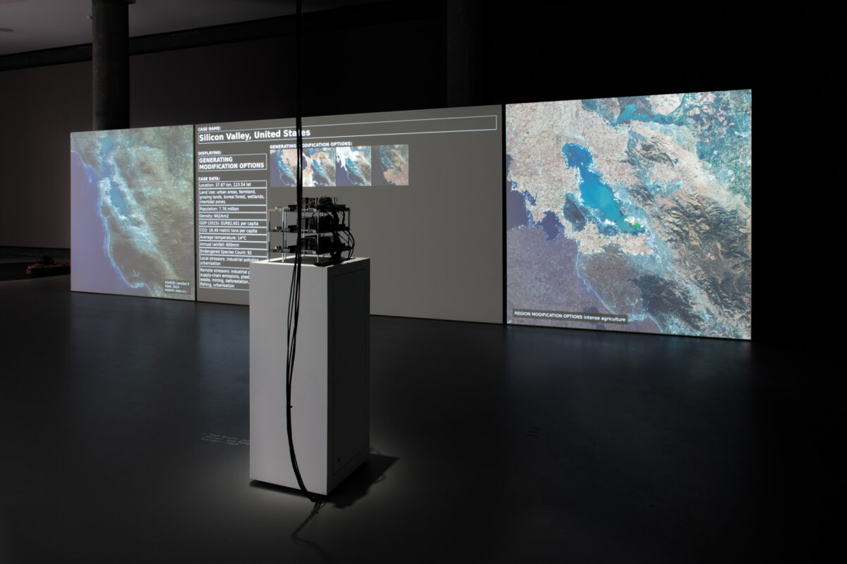
Imagine the earth as a networked system whose data can be collected, analyzed, and acted upon to attempt to solve critical environmental challenges. In Asunder, a supercomputer analyzes satellite, climate, and geology data of terrestrial regions, generating environmental engineering plans that address human and nonhuman agendas. These scenarios of redesigned landscapes and ecologies are then simulated and their environmental performance assessed. The system dashboard displays each region's historic satellite data on the left, the process of the algorithm and simulation in the center, and the proposed “solution” on the right. As farmlands are relocated, coastlines straightened and rivers moved, the work shifts from humorous to preposterous, from eco-fetishistic to bureaucratic.
Man stelle sich die Erde als vernetztes System vor, dessen Daten sich sammeln, analysieren und nutzen lassen, um kritische Umweltprobleme zu lösen. In Asunder analysiert ein Supercomputer Satelliten-, Klima- und Geodaten der Erdregionen, um umwelttechnische Maßnahmen für menschliche und nichtmenschliche Agenden zu planen. Diese Szenarien zur Neugestaltung von Landschaften und Ökologien werden dann simuliert und ihre Umweltleistung bewertet. Das System-Dashboard zeigt links die historischen Satellitendaten der jeweiligen Region, in der Mitte den Prozess des Algorithmus und der Simulation und rechts die vorgeschlagene „Lösung“. Mit der Umsiedlung von Ackerland, der Begradigung von Küsten und der Verlagerung von Flüssen wechselt die Arbeit von humorvoll zu lächerlich, von öko-fetischistisch zu bürokratisch.